Create an Application
Once a camera has been created, it allows for the definition of any number of applications. Applications serve as the central component of Isarsoft Perception, transforming video streams into metadata.
Each application must be assigned to precisely one camera. This assignment is accomplished by selecting from the camera overview in Step 3 "Input Camera" (URL path: /isarsoft/app/applications/add), either through the preview image or the list view. Subsequently, the applications overview displays all applications created in the system, presented either with preview images or as a list. Applications can be added, edited, or deleted from this overview.
Deleting an application will remove all associated data.
Finding cameras is simplified through a filter and search function.
Application Type
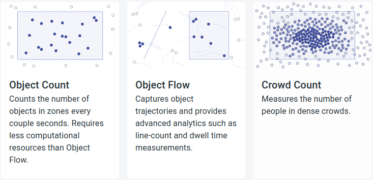
Isarsoft Perception supports three application types: Object Count, Object Flow und Crowd Count.
When georeferencing is stored in the underlying camera, the application can compute the position and velocity of objects in GPS coordinates.
Object Count
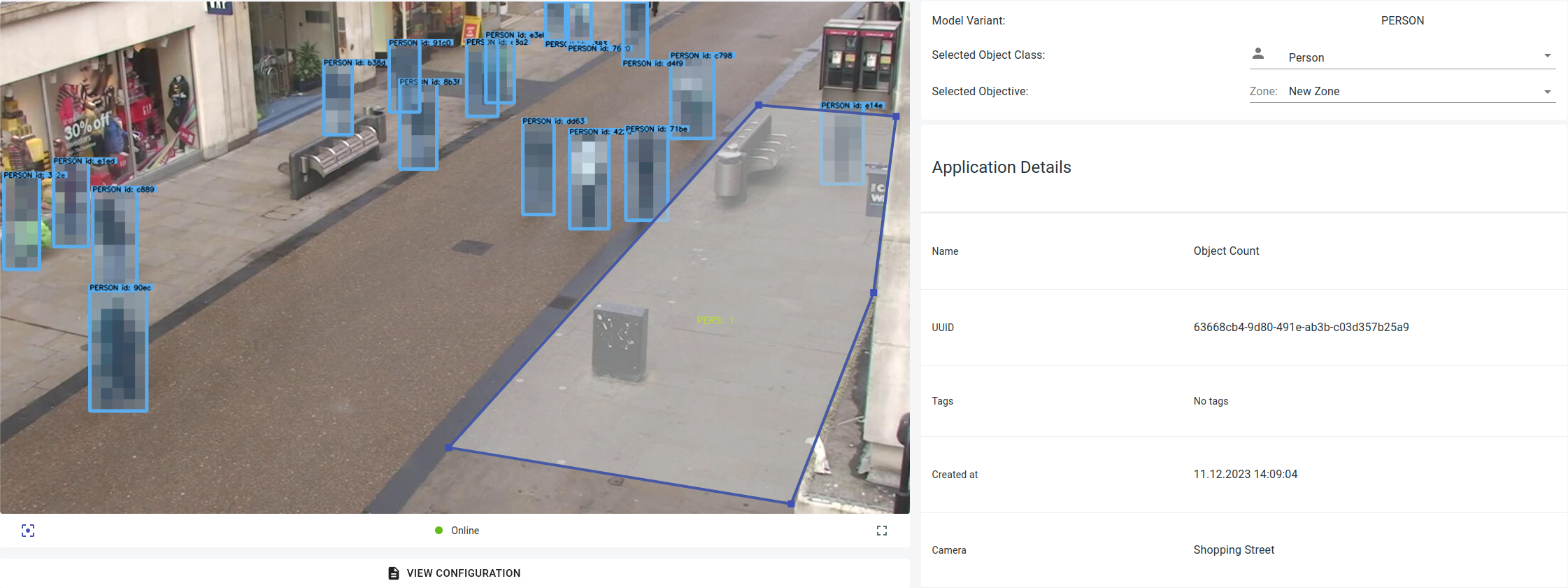
The Object Count application quantifies the number of objects within counting areas at regular intervals. In contrast to the Object Flow application, the Object Count application demands fewer computing resources.
Object Flow
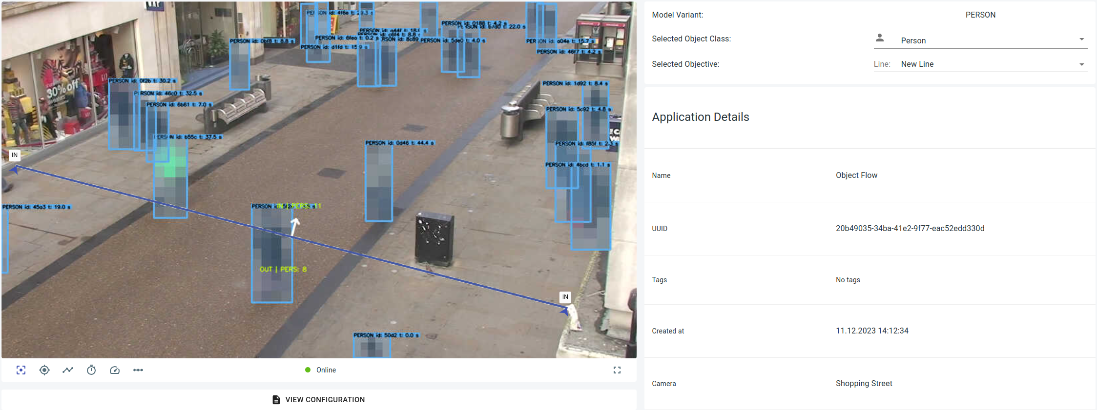
The Object Flow application tracks the trajectories of objects and offers area and line counting as well as dwell time.
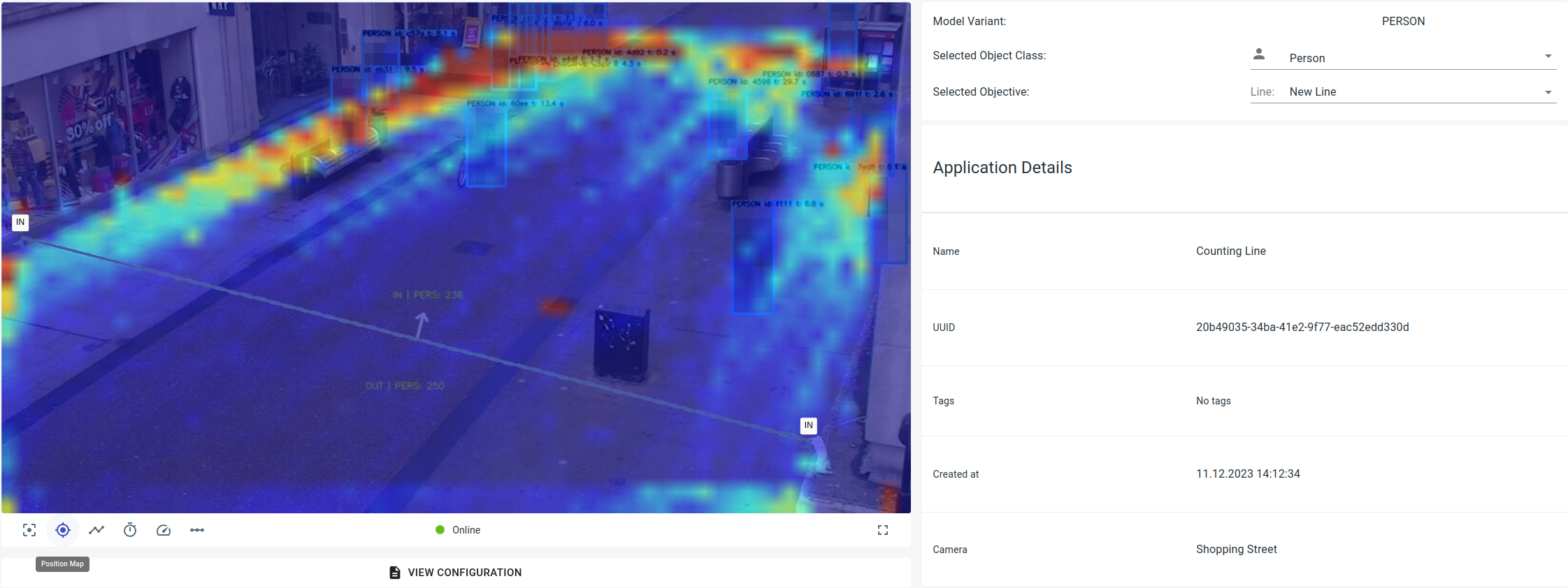
Within Object Flow, additional heat maps can be generated and accessed in the lower-left area of the image:
Position Map
A position map illustrates the most frequently visited locations where objects are situated within the designated area.
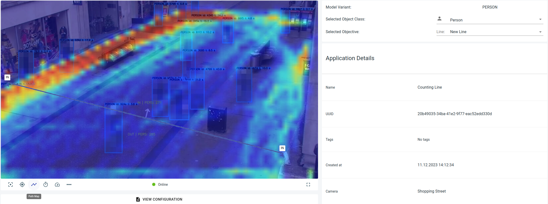
Path Map
The path map shows the most frequented routes of the objects in the marked area.
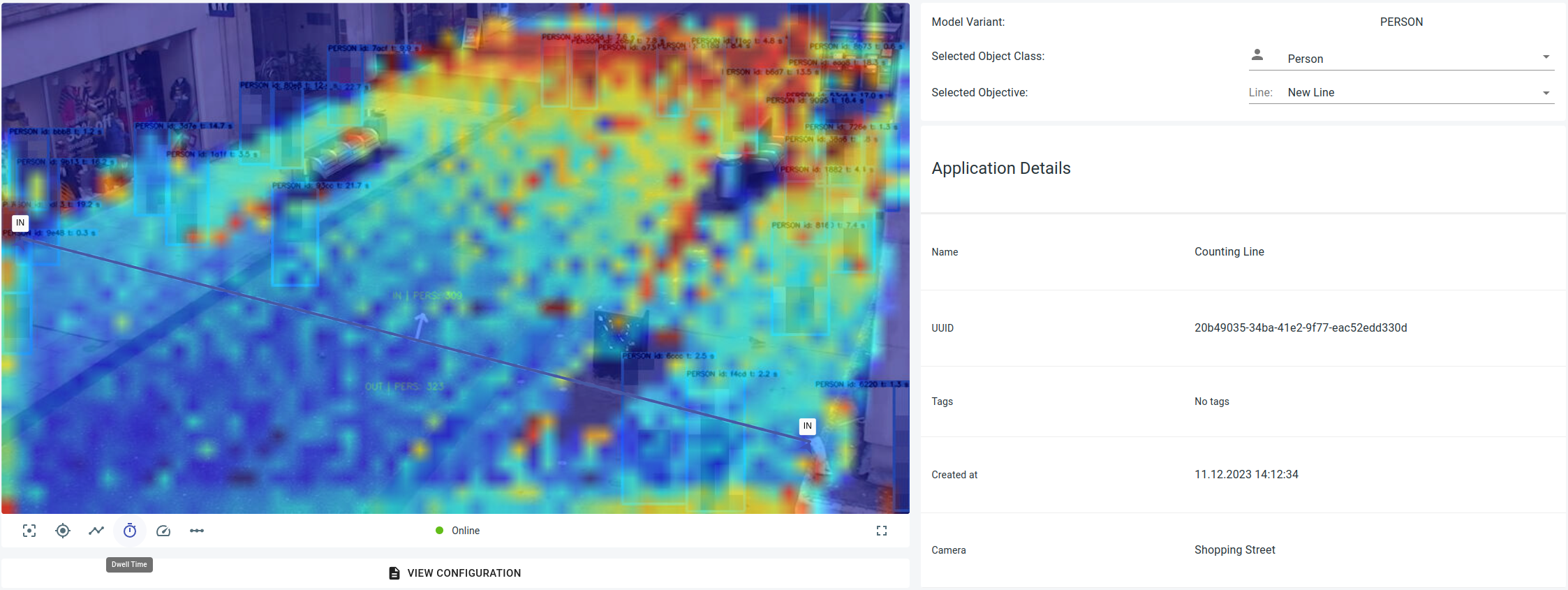
Dwell Map
A dwell map depicts the average dwell time of an object at a specific location within the designated area.
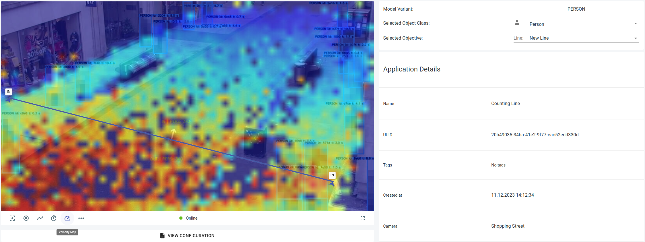
Velocity Map
A velocity map displays the average speed and direction of the object's movement.
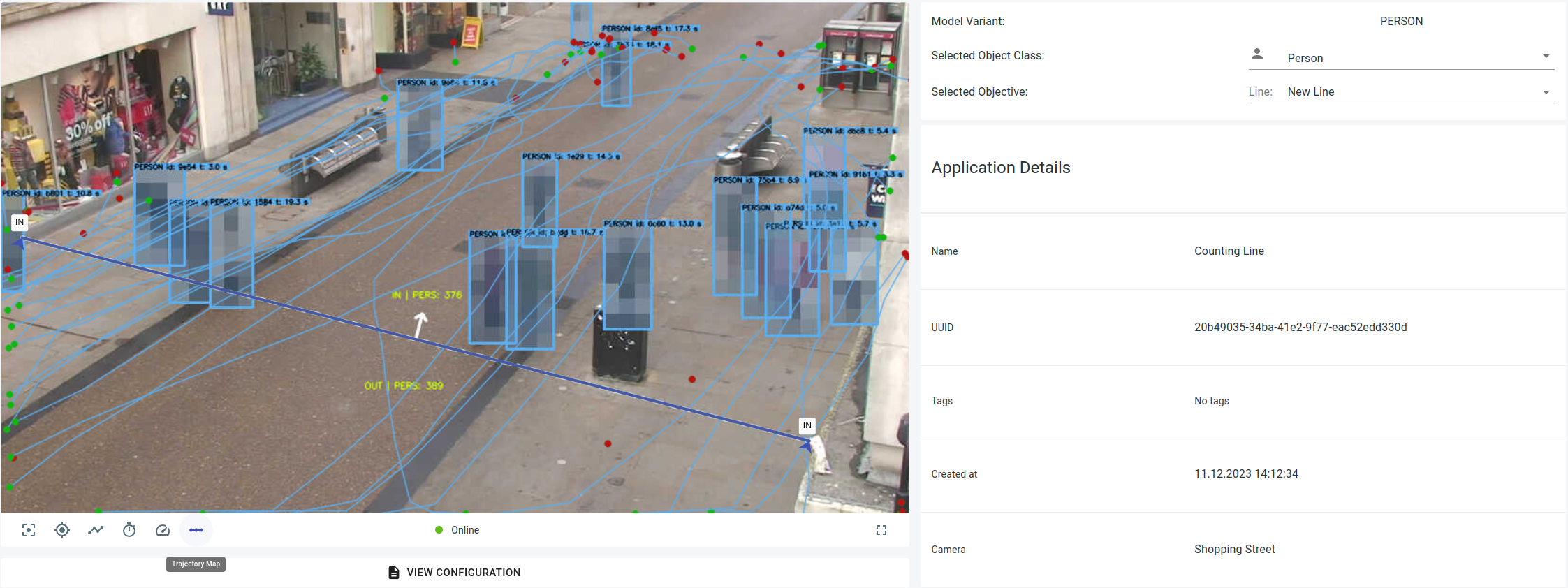
Trajectory Map
A trajectory map is defined as a two-dimensional Cartesian visualization of a given variable moving along its trajectory at a given time.
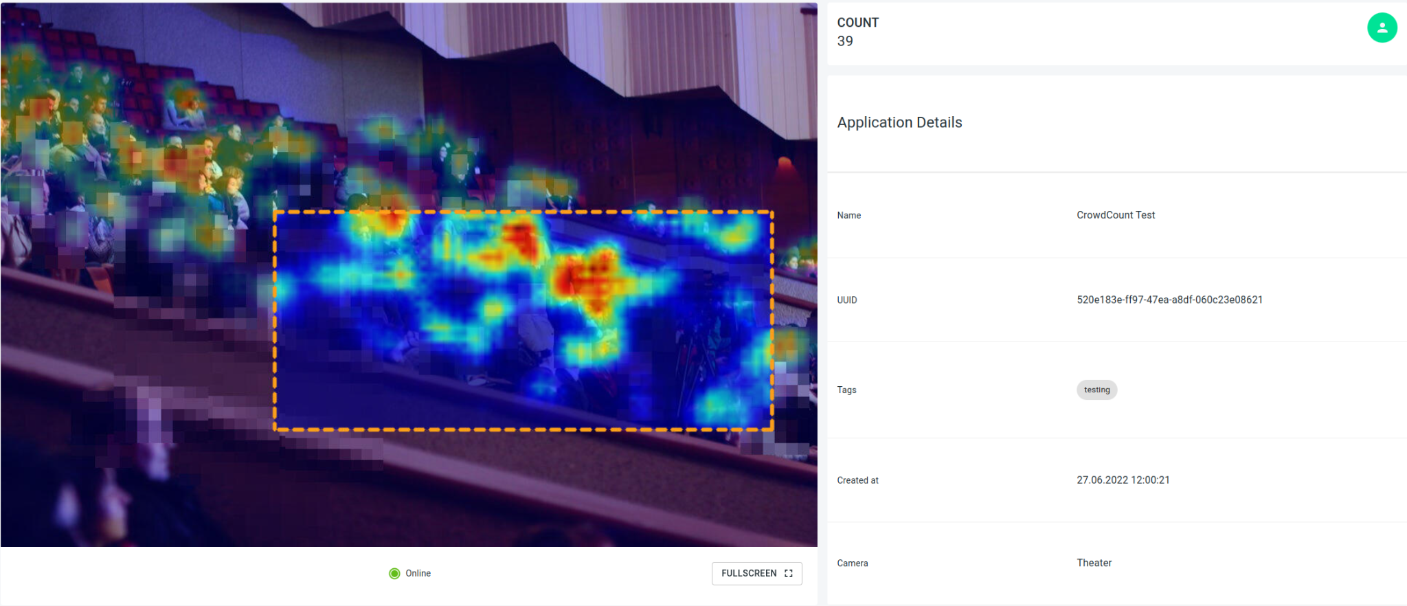
Crowd Count
The crowd count application measures the number of people in dense crowds.
Model Variant
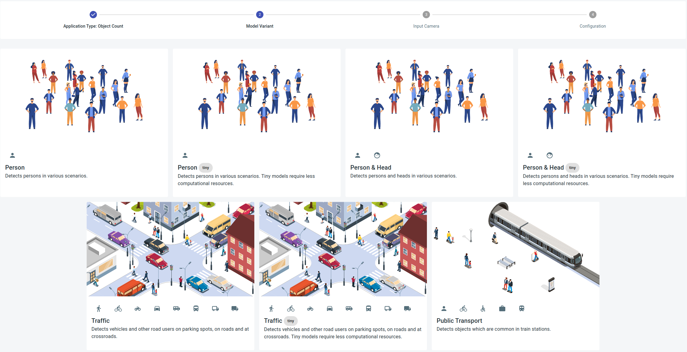
For Object Count and Object Flow various model variants are available. The fundamental model for person recognition is the Person model. In contrast, the tiny version demands fewer computing resources and may exhibit lower precision, particularly over longer distances.
Public transport expands beyond pure person recognition to encompass object categories like bicycles, wheelchairs, luggage, and trains. The traffic model broadens detection to include typical road users such as cars and trucks.
For the Crowd Count only one model variant is available, eliminating the need for configuration in this case.
Configuration
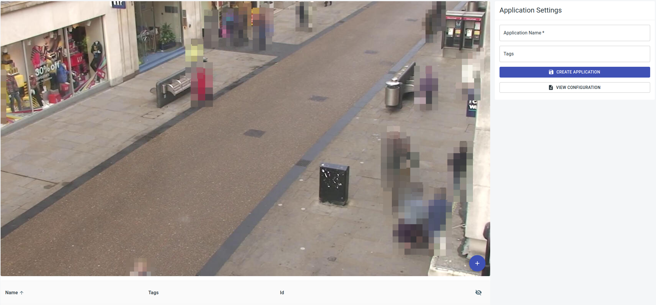
To create an application, entering an application name is essential. While tags are optional, they facilitate later identification and grouping of applications.
Configuration of the application occurs on a preview image of the respective camera. The supported counting objects vary depending on the application. The table below provides details on the specific counter objects that can be configured for each application type.
| Object Count | Object Flow | Crowd Count |
|---|---|---|
| Any number of polygons | Any number of polygons | A single rectangle |
| Any number of line |
Counting Areas
To establish a counting area, start with a name. While tags are not obligatory, they enhance the ease of locating the counting area later. For Object Count and Object applications, many polygonal areas with a minimum of three points can be configured. Crowd Count allows only one rectangular area.
Counting Lines
To establish a line, provide a name. While tags are not mandatory, they facilitate locating the counting line later. Lines are defined by two points and a counting direction. The direction is represented by arrows on the edges, labeled "in".
Application View
Clicking on an application in the application overview directs you to the specific application view. The evaluation, along with its counting data, is visualized here, providing the option to make configuration adjustments for the application and display heatmaps, dwell maps, and the detected objects on a map.
Alarms
Alarms can be set up in the system based on the configured cameras and applications, notifying the user when the specified alarm conditions are met.
Alarm Overview
The alarm overview, accessible via the URL path /isarsoft/app/alarms, presents a list of all alarms configured in the system. Alarms can be added or removed from this overview.
Deleting an alarm results in the removal of all associated data.
Locating alarms is simplified through a filter and search function.
Configuration
Alarms can be established either on applications and their associated counting objectives or directly on cameras.
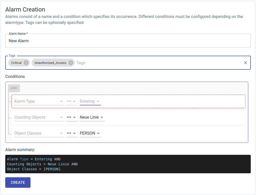
Each alarm comprises a name and a condition that specifies its occurrence. Distinct conditions must be configured based on the alarm type, and tags can be optionally specified.
The alarm summary consolidates the alarm information into a logical statement.
The various alarm types are detailed as follows:
-
Count Sum: The count sum of selectable object category (e.g. > people, suitcases, bicycles, etc.) from several selectable areas > greater than the threshold. This is evaluated every 5 seconds.
-
Duration of stay: Selectable object category stays longer than > the threshold value (in seconds) in area. This is evaluated every > 5 seconds for each object in the area.
-
Background Change: Camera background model has changed more than > percentage threshold (0.0 - 1.0).
-
Exit: Selectable object category leaves area or crosses line > towards OUT. This is an event and is triggered in real time.
-
Enter: Selectable object category enters area or crosses line in > direction IN. This is an event and is triggered in real time.